
Verified Bessemer ZIP Code Relationships
The local evidence supports four different relationships, but it does not support calling all four numbers Bessemer delivery areas. USPS verifies the Bessemer station for 35020. A Jefferson County office uses a 35021 post-office box. Census names 35022 as a Bessemer ZCTA. USPS assigns the 35023 station to Hueytown, and any overlap with incorporated Bessemer requires parcel and boundary evidence.
| Postal number | Verified local relationship | Post office or source | Use note |
|---|---|---|---|
| 35020 | USPS Bessemer station and address | 1112 4th Avenue N, Bessemer | Primary verified city-named postal area |
| 35021 | Used by the Bessemer Tax Collector's PO Box 1190 | Official county contact record | PO-box-only status not verified |
| 35022 | Census labels it the Bessemer ZCTA | U.S. Census Bureau | A statistical area, not USPS boundary proof |
| 35023 | USPS station is in Hueytown | 615 Brooklane Drive, Hueytown | Test any city overlap in GIS |
This lead table is deliberately narrower than a commercial ZIP list. No official split or realignment year, exhaustive neighborhood crosswalk, unique institutional code, or confirmed PO-box-only classification was found. The Bessemer ZIP code directory therefore labels each fact by source and leaves those gaps open.
USPS Confirms Bessemer ZIP 35020
The official USPS Bessemer Post Office listing ties 35020 to the station at 1112 4th Avenue N. Services shown in the research include post-office boxes, General Delivery, carrier service, and retail service. This is the firmest postal anchor in the local set, yet it still does not draw an incorporated-city line or identify every person receiving mail in the area.
The image below is the successful manifest capture of the USPS station page. It documents the station and service context, not the residence of any named person.
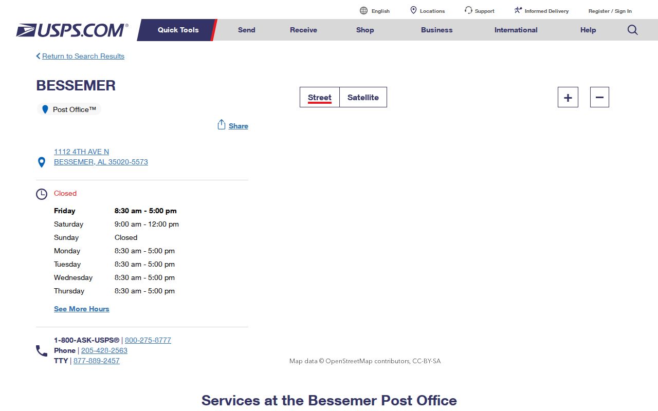
Use the station page to verify the postal label. Use a parcel municipality field, the Census incorporated-place map, or a city annexation record when the real question is whether an address lies inside Bessemer.
Bessemer 35022 ZCTA Is Not Postal
The Census Bureau identifies 35022 as a Bessemer ZCTA. A ZIP Code Tabulation Area is a generalized statistical representation built so Census data can be summarized around common mailing patterns. It is not the Postal Service's live delivery geometry, and it is not Bessemer's incorporated boundary. That distinction matters whenever a directory search mixes demographic tables with current addresses.
Population or age facts drawn from a ZCTA describe that statistical area, while Bessemer QuickFacts describes the incorporated city. The two should never be substituted without checking the geography label. For an individual address, move to the county parcel layer and compare municipality, division, situs fields, and the property postal field.
Bessemer ZIP Questions for 35021 and 35023
Two numbers require especially careful wording. The Jefferson County Tax Collector uses PO Box 1190, Bessemer, AL 35021. That proves official use of the mailing line, but the research did not verify that 35021 is exclusively for boxes or define its spatial coverage. A directory should preserve it as an observed official address, not turn it into an unsupported boundary.
USPS places the 35023 post office at 615 Brooklane Drive in Hueytown. A Bessemer-city overlap is possible only if authoritative parcel and incorporated-boundary data demonstrate it for the specific address. The mailing city shown on an envelope does not decide municipal jurisdiction, county division, or where a deed and court matter belongs.
Neighborhoods in the Bessemer ZIP Directory
Bessemer's official MS4 report supplies real neighborhood names without claiming a postal crosswalk. Its list includes Downtown, North Side, Braswell Homes, Southside, Davis Heights, Asbury Howard, Sloss Village, Brickyard Hill, Muscoda Hill, Cloverdale, Longbrook Estates, Jonesboro, Kate Walter Homes, Westlake, Skyview Estates, Lakewood, Thomas Acres, Woodland Hills, and Westwood.
These names help describe local context after an address has been placed on the map. They do not establish that every block in a named neighborhood shares one mailing number. A cautious search records the neighborhood label, parcel municipality, Bessemer Division field, and physical address as separate facts. That preserves the city's Jones Valley geography without inventing a ZIP-to-neighborhood table that no official source supplied.
The city's landscape also explains why simple label matching can fail. Bessemer developed amid ore and limestone in Jones Valley, then expanded through later annexations. Neighborhood history, postal delivery, and the legal city edge can shift on different schedules. When a family clue names Muscoda Hill, Jonesboro, or Westlake, use the name to orient the search, then let the current parcel and boundary sources settle jurisdiction.
Find Bessemer Residents by ZIP
No verified CAPture search form or parcel-wide ZIP filter was captured, so the workflow should not promise one. Instead, begin with a confirmed address or a lawfully obtained voter-file extract, then use the official county map to test the address. The statewide voter-file request does provide residence and mailing fields plus district and division choices, but it is an ordered file rather than a casual public directory screen.
- Confirm the mailing number and station relationship in the USPS location tool.
- Open the Jefferson County GIS hub and identify the subject parcel.
- Record municipality, Bessemer Division, situs address, property ZIP, owner mailing address, and parcel number separately.
- If ordering the Alabama voter file, specify jurisdiction, status, delivery format, and only the fields needed.
- Narrow the result to a road and continue with the Bessemer street directory instead of treating a postal area as a household list.
The voter request form can include full name, status, residence, mailing address, phone when available, registration date, last election, and many district fields. Social Security and driver-license numbers are withheld. Election history shows participation, never ballot choice. Electronic records cost $0.01 per voter, with a quote before payment; paper is $1 per page.
My Voter Page is a different channel. It confirms an individual's registration status, ballot status, polling place, and address, and Jefferson users must select the relevant election in the Election Detail menu. The dynamic identity fields were not captured in the research, so follow the live prompts without claiming a specific field set. For an offline question, the ordered statewide file can also be limited by municipality, precinct, council district, or Jefferson Birmingham/Bessemer Division.
Bessemer Physical and Mailing ZIP Fields
Jefferson County's parcel metadata gives the most useful field inventory for checking one address. It defines owner-name lines, full situs components, municipality, Division, property ZIP, legal description, subdivision and plat references, neighborhood name or code, and owner-mail fields such as PROP_MAIL, CITYMAIL, STATE_Mail, and ZIP_MAIL. The metadata expressly warns that PROP_MAIL may not be the physical location.
| Parcel field | What it contributes | What it cannot prove |
|---|---|---|
| Situs components | Physical property address as carried in the parcel data | Every person who occupies the site |
| Property ZIP | Postal value associated with the parcel location | Incorporated-city membership by itself |
| PROP_MAIL and ZIP_MAIL | Owner's mailing destination fields | That the owner lives on the parcel |
| Municipality and Division | Local jurisdiction clues, including Bessemer division geography | A substitute for checking the current map |
| ParcelNo and legal description | Stable keys for deed and map research | A postal delivery route |
Some utility, zoning, square-footage, and school fields are marked not valid or current, and deed images are not part of the GIS layer. Carry the parcel number and legal description into Landmark when ownership history is needed.
Postal Labels Versus Bessemer City Limits
The Census Boundary and Annexation Survey map supplies the incorporated-place line. Bessemer annexation ordinance 3599 from 2020 shows why that line changes independently: land entered the city through an owner petition and legal description. Postal labels need not change at the same moment or follow that legal boundary.
Boundary rule: Use USPS for mail service, Census ZCTA for statistics, and parcel plus incorporated-boundary evidence for city membership.
This mismatch also affects records jurisdiction. Jefferson County is headquartered in Birmingham, while Bessemer has a separate Probate, assessor, tax, and trial-court division. A Bessemer mailing line alone does not establish that a parcel belongs in the Bessemer Cut-Off. Preserve the parcel Division field before moving to land or court records.
- ZIP and ZIP+4
- The five-digit postal area and a more precise four-digit delivery segment appended to it. Neither is an incorporated-city boundary.
- PO-box ZIP
- A postal number assigned for box delivery. Research did not establish that status for 35021, so it remains unclassified here.
- Unique ZIP
- A number assigned to one high-volume organization or site. No verified Bessemer example was located.
- Carrier route
- A Postal Service delivery grouping within a broader area, useful for mail operations but not a roster of residents.
The safest Bessemer ZIP code directory result is therefore a layered one. State which geography supplied each fact, keep uncertain classifications marked as uncertain, and verify the subject address in the office or portal that owns the next record.
City planning names such as Muscoda Hill, Jonesboro, Westlake, Lakewood, and Woodland Hills supply useful local context, but they are not postal zones. A neighborhood can cross a delivery pattern, and a single ZIP can cover several named places. For a precise Bessemer result, save the situs ZIP, owner mailing ZIP, municipality, and division as separate fields. That record makes later deed, voter, or court research easier to audit when the labels disagree.